Sapphire Mountains / Michael Schweppe
The Sapphire Mountains are located in southwest Montana, along the eastern edge of Montana’s Bitterroot Valley.
The range is 50 miles wide at its widest point as it separates the Bitterroot Valley from the Flint Valley.
The highest peak in the range is Kent Peak, which reaches an elevation of 8,999 feet above sea level.
This article highlights the facts, figures, wildlife and public lands you’ll find in Montana’s Sapphire Mountains.
Content may include affiliate links. As Amazon Associates, we earn from qualifying purchases at no cost to you
The Sapphire Mountains — A Gem of a Mountain Range
Beginning near Mount Sentinel in Missoula, MT, the Sapphire Mountains extend south for 60 miles.
They form the eastern edge of the Bitterroot Valley, and their gentle skyline is in full everywhere in the valley.
The Bitterroot Mountains are better known, but the Sapphire Mountains are equally impressive in their own way.
The Sapphire Mountains viewed from the Bitterroot Mountains / Bob Danley/USFWS
The Sapphires are known for their scenic beauty, seasonal wildflowers, and plentiful recreational opportunities.
They are also known for producing some of the finest Sapphire gemstones in the world.
With great access to miles of public roads, the Sapphire Mountains are a favorite of outdoor adventurists.
popular articles on Bitterroot Info
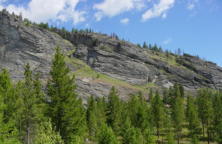
Rolling Hills & Rocky Slopes
The foothills along the east side of the Bitterroot Valley turn into rolling hills as the Sapphire Mountains emerge from the valley floor.
These rolling hills eventually turn into steep, rocky ridges and peaks, with several peaks exceeding 8,000′ in elevation.
While not as tall or extreme as the Bitterroot Mountains to the west, the Sapphire Mountains are a spectacular range with plentiful access and memorable views.
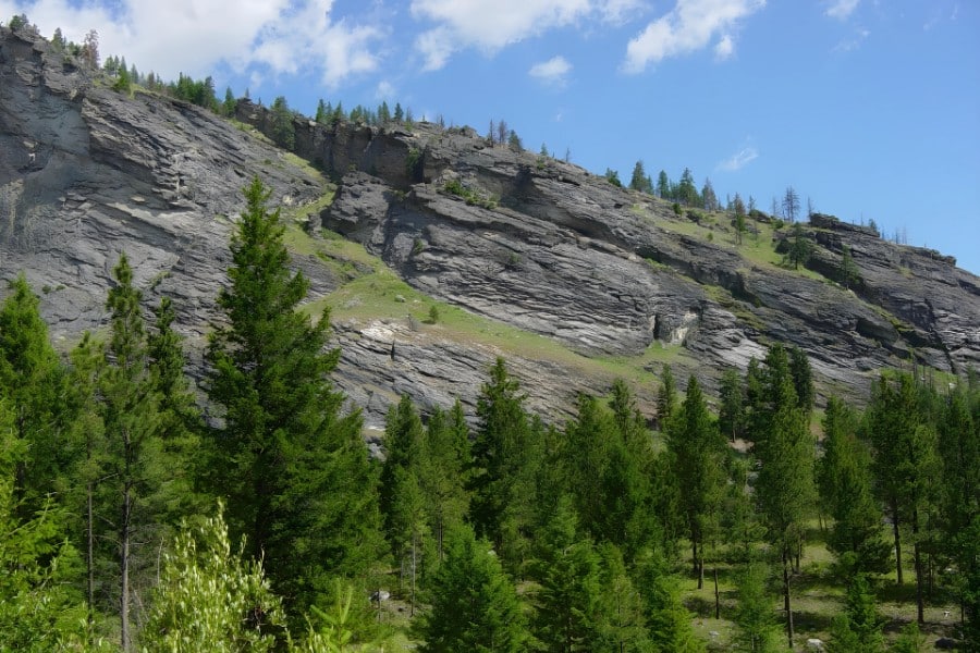
View of Sapphire Mountains near Stevensville, MT
It’s hard to fathom that tens of millions of years ago what’s now the Sapphire Mountains broke off of the Idaho Batholith to the west, and over a period of several million years, made their way east to their current home.
To the trained eye, you can still see where the Sapphire Block slid off what’s now the Bitterroot Mountains to begin its journey miles to the east.
It’s a fascinating story of natures raw power, and our Bitterroot Mountains article features a great video that summarizes what actually happened way back when.
The Sapphire Mountains are Nature at its Finest
As with all mountain ranges in western Montana, the Sapphire Mountains are loaded with magnificent plants and animals.
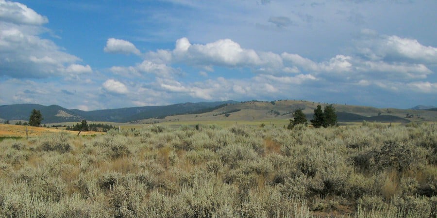
The range features dense pine, fir and spruce forests, as well as large grassy meadows and thousands of acres of sagebrush covered land.
Summer wildflowers and berries keep locals heading to the hills, and the lucky ones may stumble upon some blooming beargrass plants that are four or five feet tall.
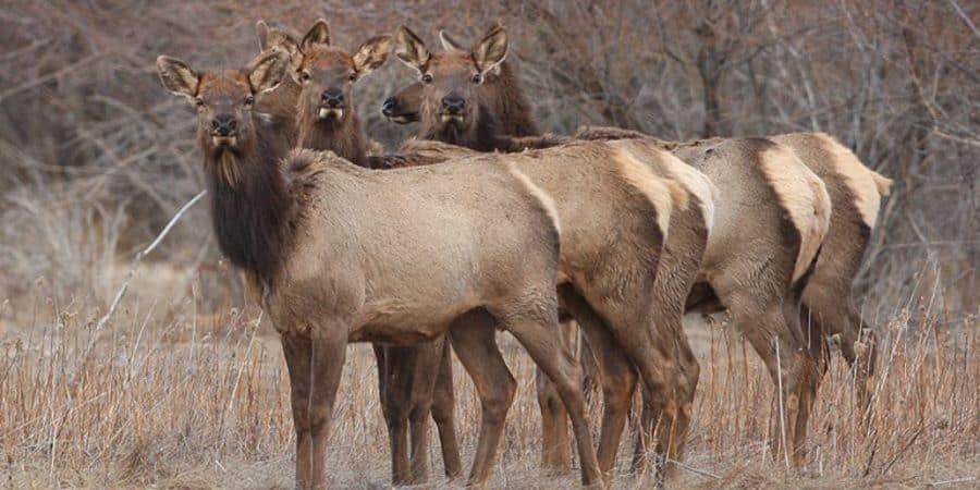
Rocky Mountain Elk
The Sapphires are home to a wide variety of wildlife, including bear, moose, mountain lion, deer, elk, wolves, mountain goats, and bighorn sheep.
Several important wildlife corridors have been established by conservation organizations throughout the Sapphire Mountains, playing an important role in mitigating the impact of ongoing human development on area wildlife.
A Unique Blend of Public Lands
The Sapphire Mountains include thousands of acres of public lands, including two National Forests and two Wilderness Areas.
There’s also a Wildlife Management Area, a Game Preserve, and three large roadless areas.
That’s a lot of public use land for a relatively small mountain range.
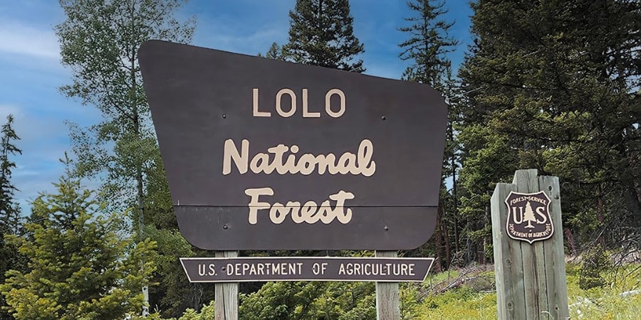
The mountains host the Lolo National Forest in the north, and the much larger Beaverhead-Deerlodge National Forest in the south.
Together they provide thousands of acres of public land in one of the most beautiful areas in Montana.
The Welcome Creek Wilderness Area and the Anaconda-Pintler Wilderness Area combine to provide almost 30,000 acres of pristine, undeveloped land.
The Threemile Wildlife Management Area is home to abundant wildlife viewing, bird watching, hiking, biking and hunting opportunities.
The 23,000 acre Skalkaho Game Preserve near Darby is one of the most popular locations for wildlife viewing in the area.
The Sapphire Mountains also feature 3 large roadless areas that total 360,000 acres.
These areas provide hundreds of miles of trails to enjoy for those seeking to avoid motorized vehicles.
join us • Bitterroot Info
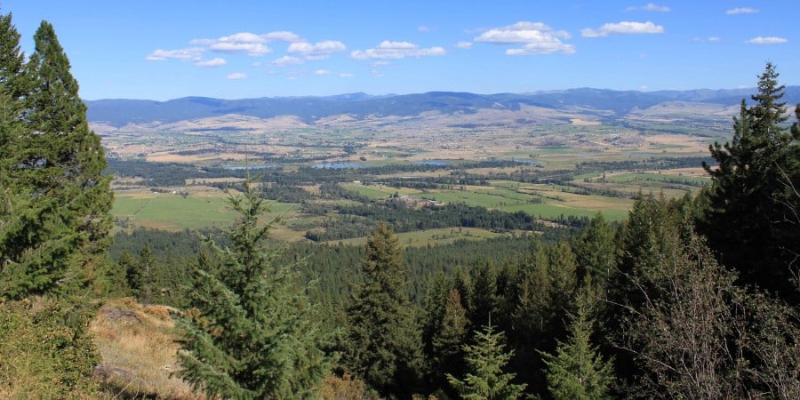
Recreation Galore in the Sapphire Mountains
The Sapphire Mountains are full of recreational opportunities.
Residents and visitors have great access to the mountains from the east and the west, and much of the mountain range is covered with abandoned roads from past logging activity years ago.
This road network is a paradise for hiking, mountain biking, ATV’s and snowmobiles.
The mountains are quite popular for camping, hiking, and backpacking, as well as rock climbing, bouldering and skiing.
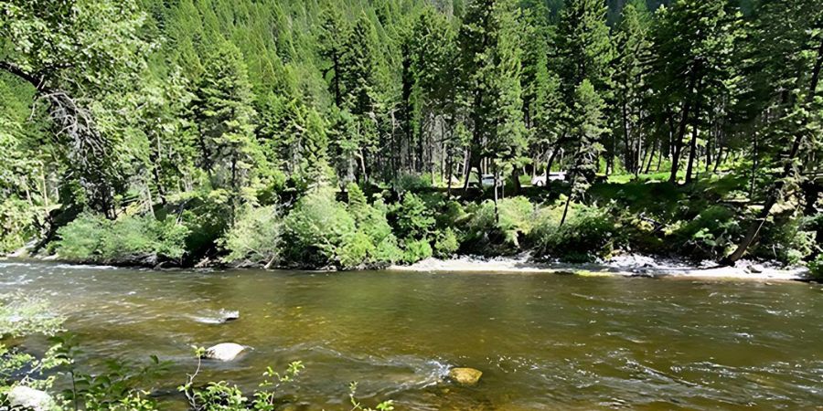
Rock Creek in the Sapphire Mountains
There are many lakes, rivers, and streams that provide a wide variety of wonderful fishing opportunities.
Rock Creek runs along the east side of the Sapphires, and is one of Montana’s prized blue ribbon trout streams.
Skalkaho Creek runs along Highway 38 on the western side of the range and is known for producing large trout for such a small creek.
Fuse lake supports a population of Arctic Grayling, and draws the attention of fishermen who want to experience catching one of these rare fish themselves.
The mountains support large populations of deer and elk, which creates terrific hunting opportunities for big game enthusiasts.

Skalkaho Pass in the Sapphire Mountains
And people aren’t the only hunters as the Sapphires are known to support two healthy wolf packs.
Making the adventurous drive on the Skalkaho Road over Skalkaho Pass is also quite popular during the summer.
This route takes you past spectacular Skalkaho Falls.
This is a popular day trip for those wanting to experience the Sapphire Mountains from the comfort of their vehicle.
Sapphire Mining
The Sapphire Mountain Range was named after the gem quality sapphires that were found along Rock Creek in the late 1800’s and early 1900’s.
The Sapphire Mountains are home to the famous Montana sapphires, which are known as some of the finest sapphires in the world.
While most miners in Montana were focused on silver and gold, the miners in the Sapphires were looking for these prized gemstones.
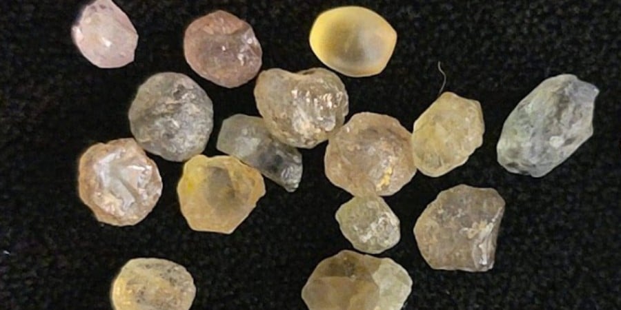
Raw Montana sapphires
Montana sapphires are often a unique shade of blue, and are highly sought after by jewelers and collectors.
More than 40 tons of sapphires were mined from the area until synthetic sapphires were developed, killing much of the demand for the natural stones.
Sapphire hunting is still quite popular in the summer months with mining operations open to the public near the town of Philipsburg.
That’s a Good Question
The mountains are located in southwest Montana, just south of Missoula, MT.
Several peaks exceed 8,000 feet, with the tallest point being Kent peak at 8,999 feet in elevation.
Additional Resources
Beaverhead-Deerlodge National Forest public resources in the Wisdom Ranger District
Lolo National Forest public resources in the Rock Creek Area