The Bitterroot River flows north for 84 miles through Montana’s Bitterroot Valley.
From the confluence of its east and west forks near Conner, to the confluence with the Clark Fork River in Missoula, the Bitterroot River anchors the Bitterroot Valley.
World class fly fishing, incredible wildlife habitat, and summer recreation all depend on this important resource.
This article provides facts, figures, and detailed information about the Bitterroot River.
Content may include affiliate links. As Amazon Associates, we earn from qualifying purchases at no cost to you
The Bitterroot River is Simply Awesome
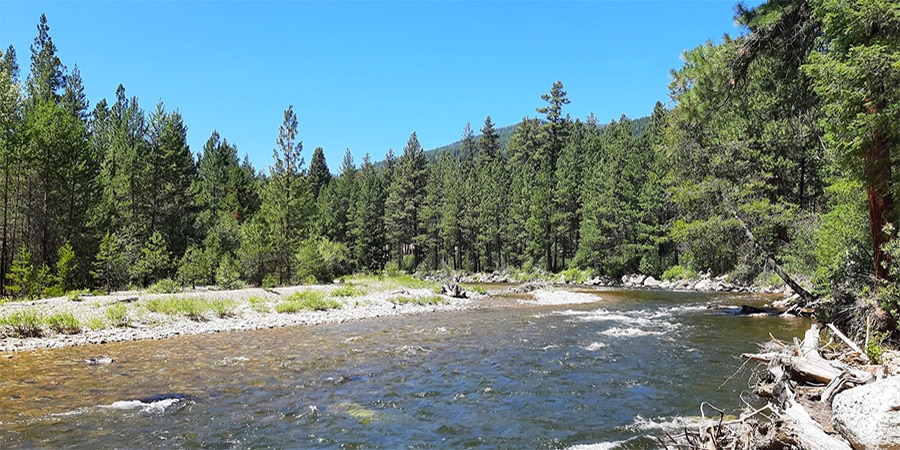
Throughout its journey, the Bitterroot River flows through miles and miles of scenic Montana paradise.
The river is flanked by the rugged Bitterroot Mountains to the west and the gentile Sapphire mountains to the east as it winds its way through the grasslands and woodlands that dominate the valley floor.
Wildlife surrounds the river in a huge ecosystem of plants and animals that call the Bitterroot River home.
It’s the heartbeat of the Bitterroot Valley.
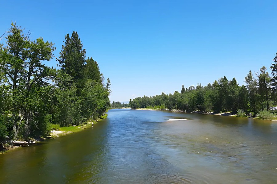
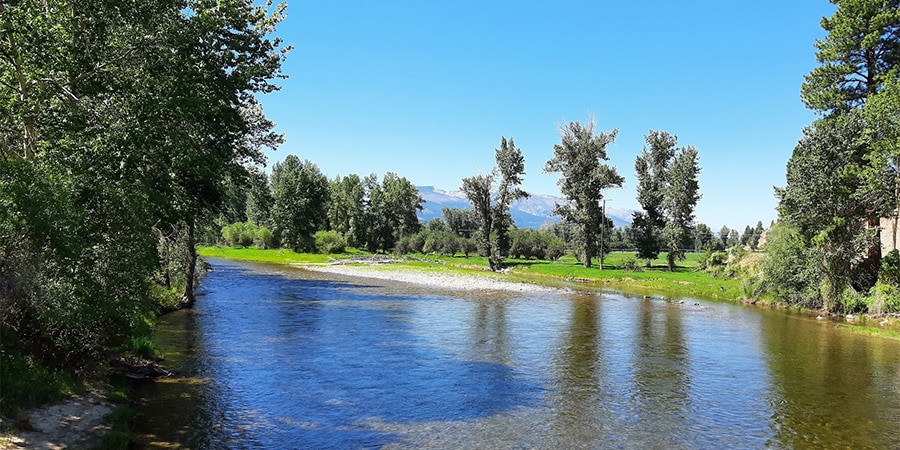
Bitterroot River in Hamilton, MT / Bitterroot Info
The river supports farmers, ranchers, recreationalists and sportsmen who all rely upon the river for a variety of purposes.
Summer tourism flourishes in the Bitterroot Valley because of the river, supporting local businesses that make their living serving our visitors.
It’s hard to imagine the Bitterroot Valley without the spectacular Bitterroot River.
join us • Bitterroot Info
Bitterroot River Facts & Figures
The Bitterroot River flows 84 river miles from the confluence of the East and West forks to the confluence with the Clark Fork River in Missoula.
Lewis and Clark explored and camped along the Bitterroot River during their epic journey in 1805 and 1806.
The river flows south to north, which is not common around here.
The river loses an average of 12 feet per mile in elevation, which is an unusually mild gradient.
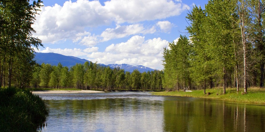
Bitterroot River Views Looking Northwest / Merle Ann Loman
Due to the many tributaries that join the river, the flows at its mouth near Missoula are 2.5 times the flow at its origin near Conner.
The Bitterroot River is the 3rd most fished river in Montana behind the Madison River and the Big Horn River.
According to Montana FWP, many fish species are found in the river, including Rainbow Trout, Brown Trout, Western Cutthroat Trout, Bull Trout, Brook Trout, Mountain Whitefish, Suckers, Northern Pike, Largemouth Bass, Black Bullhead, Longnose Dace, Peamouth, Pumpkinseed, Redside Shiner, Slimy Sculpin and Yellow Perch.
The upper sections of the river contain an estimated 1,000 fish per mile.
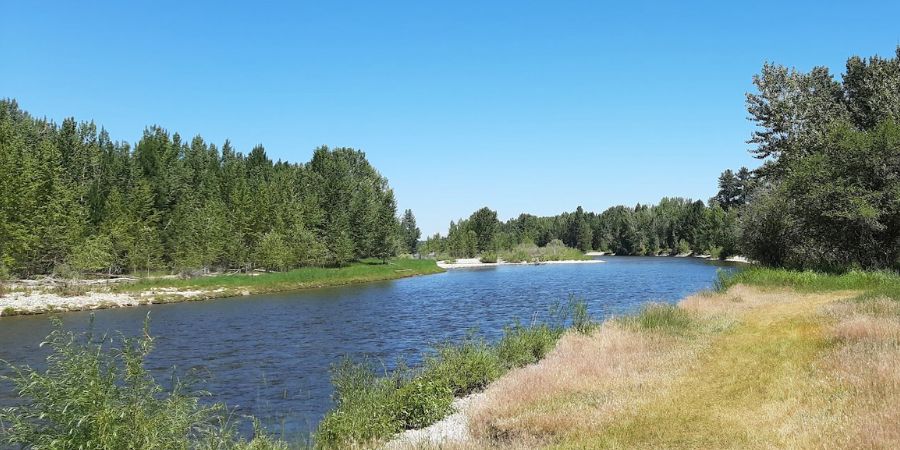
Hannon Memorial Fishing Access Site / Bitterroot Info
There are 13 official fishing access sites provided for public access to the river.
The Bitterroot Valley watershed is heavily irrigated from the river with an estimated 300 miles of ditches and canals in use.
17 miles of the mainstem of the river and 53 miles of its tributaries are classified by Montana FWP as chronically dewatered due to irrigation.
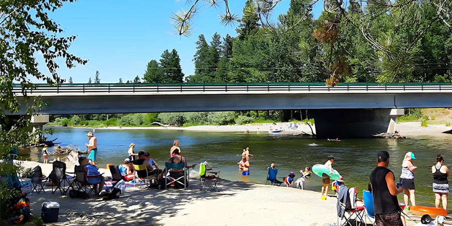
Popular Activities and Economic Impact
Many recreational activities are popular on the Bitterroot River, especially during the summer months.
Fishing, hunting, wildlife viewing, rafting, canoeing, kayaking, tubing, swimming and beach use are all common on most stretches of the river.
Visit one of the public access sites of the river during the warm months of summer and you’ll find residents and tourists enjoying themselves.
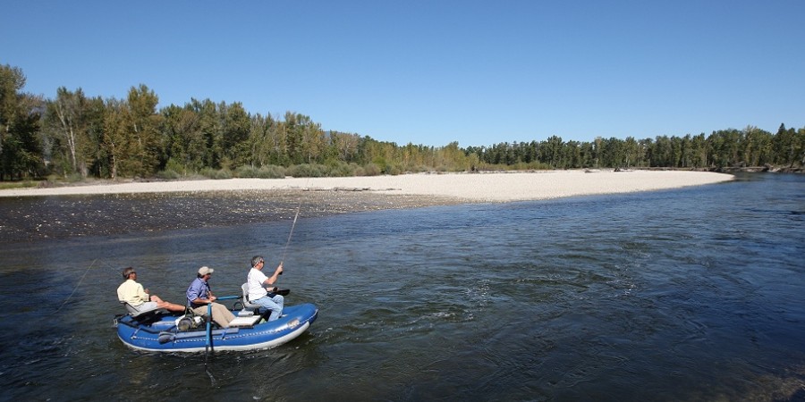
Fly Fishermen on the Bitterroot River / Bitterroot Info
Fly fishing is one of the most popular activities, with many choosing to hire local guides to float them down the river and assist with catching (and releasing) the plentiful fish.
Others choose to wade fish the river, exploring the river’s channels and braids on foot, looking for spots less accessible to the many who fish from boats and rafts.
Fishing is an important piece of the local economy in the Bitterroot Valley.
According to this report, in 2017-2018 the Bitterroot River supported 102,388 angler days, 41% of which were from non-residents.
These visitors spend millions of dollars on lodging, food, drink and tourism in the area.
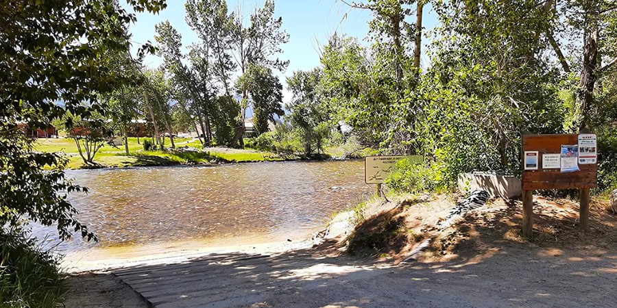
Florence Bridge Fishing Access Site / Bitterroot Info
As the river winds its way from Stevensville to Florence, it passes through Teller Wildlife Refuge and Lee Metcalf National Wildlife Refuge, where an incredible variety of birds and wildlife attract visitors throughout the year.
Many locals love to grab a bunch of inner tubes and head to the river on a hot summer day, floating in small groups from bridge to bridge.
Lodging, food and drink, gas and goodies, and a wide variety of retail and service businesses are all directly impacted by people accessing and enjoying the Bitterroot River.
While we can’t estimate the total annual economic impact of the river on the Bitterroot Valley, we know it’s a bunch.
The Bitterroot River’s Annual Cycle
The river and its tributaries are dependent on snowmelt and rainfall that create the annual streamflow.
As such, we experience great variations in the annual water cycle.
The cycle begins each fall as snow begins to accumulate in the Bitterroot and Sapphire Mountains.
As temperatures rise in April, snow begins to melt and water begins its journey to the Bitterroot River through a vast network of tributaries.
May and early June brings the highest water levels of the year, sometimes resulting in isolated and widespread flooding throughout the valley.
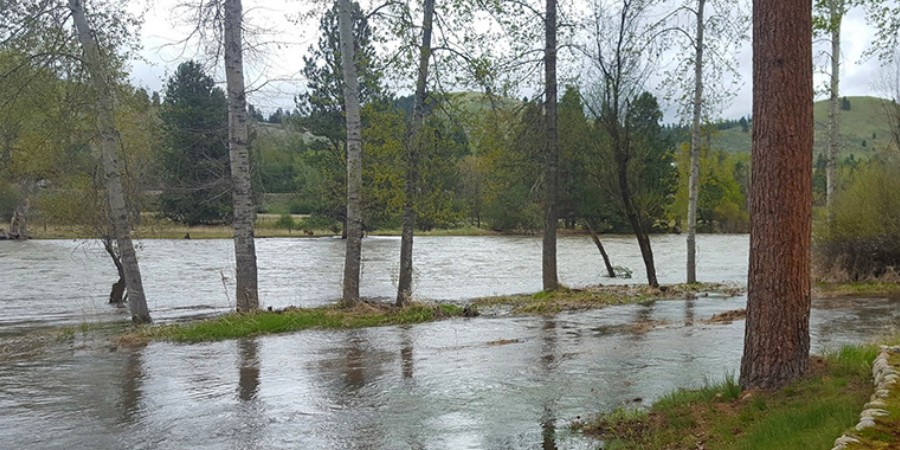
Bitterroot River Flooding in May / Bitterroot Info
By mid June the water levels have usually peaked, and by mid-July the river has returned to normal summer flows.
Warm temperatures and increased needs of irrigators combine to produce the lowest flows of the year during August.
Cooler temperatures and September rains improve flows, and as fall transitions to winter the annual cycle starts all over again.
In addition to Lake Como and Painted Rocks Reservoir, many private dams were constructed on tributaries high in the Bitterroot Mountains to store water for release as summer flows recede.
Managing releases from these reservoirs is challenging to say the least.
Many different interests are involved, and it’s difficult to serve everyone’s needs at the same time.
Determining how stored water is managed and released is as much a part of the river’s annual cycle as the weather is.
The East Fork of the Bitterroot River
The East Fork and West Fork form the Bitterroot River near Conner, MT.
Both of these are exceptional Montana streams on their own.
The East Fork begins high in the mountains above Sula, MT and flows through scenic Ross’ Hole.
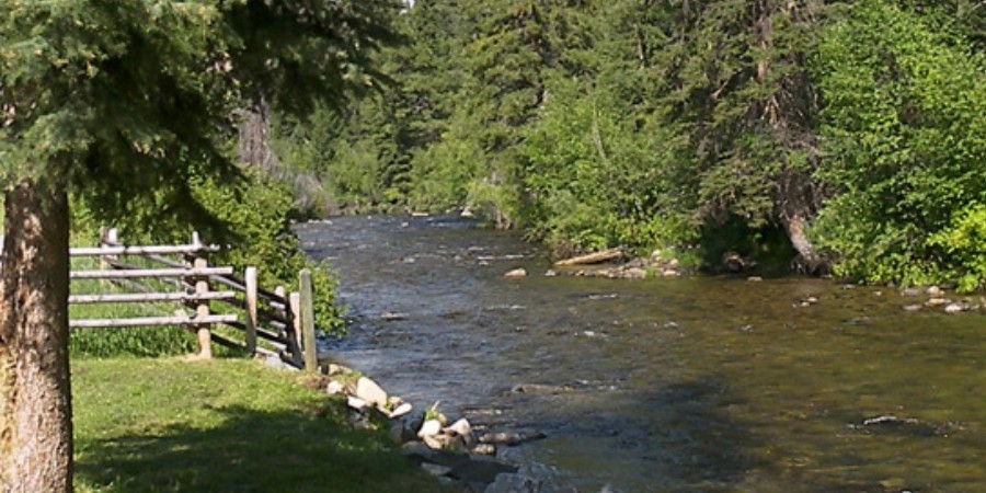
East Fork of the Bitterroot River / Bitterroot Info
If you haven’t explored this area before, we’d recommend you add it to your list.
The East Fork has a healthy fish population and offers good public fishing access to the stream.
It’s also quiet and not too overcrowded during the summer months.
The West Fork of the Bitterroot River
The West Fork originates near Shupe Idaho and flows dozens of miles through the West Fork drainage.
The West Fork is also loaded with fish, which tend to be bigger than on the East Fork.
The West Fork is quite popular with fly fishing enthusiasts throughout the fishing season.
West Fork of the Bitterroot River / Bitterroot Info
Some of the biggest fish of the year are caught on the West Fork during the epic Salmonfly hatch every June.
The West Fork Road is one of the most popular scenic drives in the area, as it winds its way along the West Fork of the Bitterroot River on its way to Painted Rocks Reservoir.
Threats to the Bitterroot River
While we choose to avoid wading too deep into the debate about development in the Bitterroot Valley, it seems obvious that ongoing growth will be an ongoing threat to the Bitterroot River.
Many of the river’s tributaries are chronically dewatered due to irrigation use, and many of them become completely dry during irrigation season.
Suburban development along the foothills and lower elevations of the Bitterroot Valley have greatly increased demand for groundwater, which also reduces surface flows and river levels.
Upper Bitterroot River at Low Water / Bitterroot Info
Low water levels reduce water temperatures, which negatively affect the health of the fishery.
Septic systems, fertilizers, sediment and invasive weeds all come with development, and none are good for the river.
Thankfully, the area boasts many organizations and concerned citizens who work to mitigate threats to the river from ongoing development.
popular articles on Bitterroot Info
That’s a Good Question
South of Missoula, MT in the spectacular Bitterroot Valley.
No. Wade fishing is popular around the 13 fishing access sites along the river.
No. Guides are popular and a great way to learn about fishing the river, but are not required.
Spring runoff is typically over by mid June.