The Bitterroot Mountains span the rugged border between Montana and Idaho, forming the western edge of the Bitterroot Valley.
The Bitterroot’s are the largest of 5 smaller mountain ranges that comprise the larger Bitterroot Range.
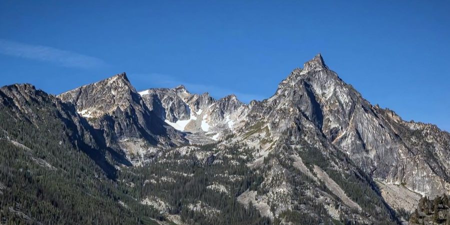
Trapper Peak is the tallest peak at 10,157 feet, offering spectacular views near Darby, MT.
This article highlights the geography, geology, location and public use of the majestic Bitterroot Mountains.
Content may include affiliate links. As Amazon Associates, we earn from qualifying purchases at no cost to you
Where are the Bitterroot Mountains?
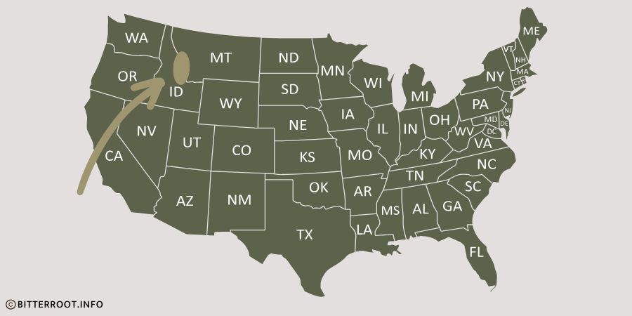
The Bitterroot Mountains are a large mountain range located along the Montana / Idaho border.
The north end of the range is near Wallace, Idaho, and the southern end is near Salmon, Idaho.
Lolo Creek and the Clark Fork River of Montana border the north and northeast edge of the range.
Map of the Bitterroot Mountains
The Bitterroot Valley and the Bitterroot River of Montana border the eastern boundary of the mountain range.
The Selway and Lochsa Rivers of Idaho border the western boundary of the range.
Idaho’s Salmon River borders the southern boundary of the Bitterroot Mountains.
join us • Bitterroot Info
Bitterroot Mountains by the Numbers
The Bitterroot Mountains are approximately 165 miles long and 75 miles wide.
According to Wikipedia, the Bitterroot Mountains encompass 4,862 square miles.
The highest peak in the Bitterroot Mountains is Trapper Peak at 10,157 feet.
Trapper Peak rises 6,555 feet above the elevation of the Hamilton, MT airport.
Trapper Peak / Bitterroot Info
The second highest peak is St. Mary’s Summit, near Stevensville, MT, at 9,351 feet.
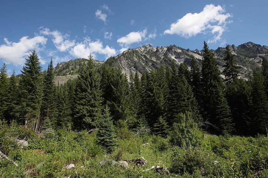
A big portion of the Bitterroot Mountain range lies within the 1.3 million acre Selway-Bitterroot Wilderness area.
The Selway-Bitterroot Wilderness Area boasts approximately 1,800 miles of unmaintained and rugged trails.
The Bitterroot Range
The Bitterroot Mountains are one of five mountain ranges that comprise the much larger Bitterroot Range.
In addition to the Bitterroot Mountains, the Bitterroot Range consists of the Coeur d’Alene Mountains, the Saint Joe Mountains, the Beaverhead Mountains, and the Centennial Mountains.
The Bitterroot Mountains are comprised of two sub-ranges, including the Northern Bitterroot Range and the Central Bitterroot Range.
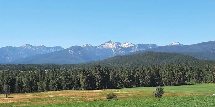
Como Peaks in the Central Bitterroot Range / Bitterroot Info
This can get a little confusing, so let’s review.
The Northern Bitterroot Range and the Central Bitterroot Range form the Bitterroot Mountains, which is one part of the Bitterroot Range.
There’s also the question of whether they are called the Bitter Root Mountains or the Bitterroot Mountains?
This one is easy — they are the Bitterroot Mountains.
How the Bitterroot Mountains were Formed
We’re not Geologists, so we’ll let someone who knows far more about this subject tell the story of how the Bitterroot Mountains were formed.
Here’s a great 5 minute video that tells the story of tectonic plates, molten magma, batholiths, and glacial events that formed the Bitterroot Mountains.
It’s quite a story and it’s worth the watch.
Video courtesy of mtnmisfits.com
If you don’t have time to watch the video, here’s a quick summary.
100 million years ago, the North American tectonic plate slammed westward into the Pacific Plate, exposing the North American Plate to the Earth’s mantle, which melted it and sent it upward, creating the 10,000-square-mile Idaho Batholith.
Over the next several million years, the top layer of the Batholith slid off the top and headed east a dozen miles, forming the Sapphire Mountains.
The rugged granite peaks that were left behind continued their upward thrust, creating the Bitterroot Mountain Range.
Later, glacial activity formed the U shaped canyons we see today.
The Bitterroot Mountains are Home to the Bitterroot National Forest
The Bitterroot Mountains, and the Sapphire Mountains to the east, are home to the Bitterroot National Forest.
The Bitterroot National Forest includes 1.6 million acres of spectacularly scenic public lands, and is a playground for many Bitterroot Valley residents and visitors.
The forest is home to a variety of wildlife including deer, elk, bears, moose, mountain lions, and bighorn sheep.
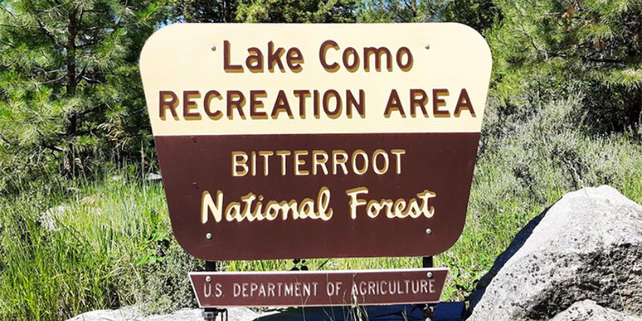
Bitterroot National Forest Sign at Lake Como / Bitterroot Info
Creeks, streams and lakes are full of fish, the sky is full of birds, and countless smaller animals thrive in the forest.
Camping is available throughout the Bitterroot National Forest at 18 improved campgrounds, and there are hundreds of miles of trails for hiking and riding.
Popular activities include hiking, fishing, hunting, rock climbing, rafting, kayaking, horseback riding and skiing.
The Bitterroot Mountains are Home to the Selway – Bitterroot Wilderness Area
A large portion of the Selway-Bitterroot Wilderness Area is within the Bitterroot Mountains.
The Selway-Bitterroot Wilderness Area includes 1.3 million acres, which ranks 3rd in total size of wilderness areas in the country.
Only Death Valley Wilderness and Idaho’s Frank Church-River of No Return Wilderness areas are larger.
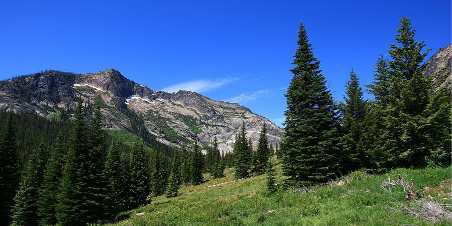
Wilderness in the Bitterroot Mountains / Bitterroot Info
1,800 miles of unmaintained and rugged trails wind their way through healthy populations of pine, fir, spruce, cedar and larch.
Only one 60 foot wide unimproved road separates the larger Frank Church-River of No Return Wilderness Area from the Selway-Bitterroot Wilderness Area.
Together, these two wilderness areas comprise some of the most expansive and rugged backcountry anywhere in the world.
That’s a Good Question
The mountains are located along the Montana / Idaho border.
The tallest peak of the Bitterroot Mountains is Trapper Peak at 10,157 feet.
The Bitterroot’s are estimated to be 55 to 80 million years old.
Yes, the Bitterroot Mountains are part of the Bitterroot Range, which is part of the Rocky Mountains.
Additional Resources
The Bitterroot National Forest website
Wikipedia’s page for the Bitterroot Range
More information about the Selway-Bitterroot Wilderness area
Related Content
popular articles on Bitterroot Info