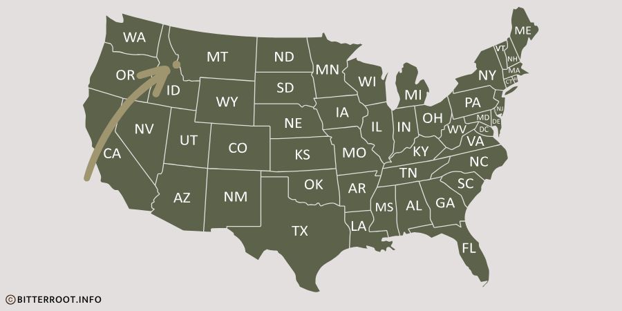
Trapper Peak is in southwest Montana, near the historic town of Darby.
It’s the tallest peak in the Bitterroot Mountains, more than 800′ taller than nearby St. Mary’s Peak.
The 10,157 foot tall jagged granite peak rises more than 6,000 feet above the Bitterroot Valley floor.
This article shares information about Trapper Peak’s location, formation, recreation, and awesome views.
Content may include affiliate links. As Amazon Associates, we earn from qualifying purchases at no cost to you
Where is Trapper Peak?
Trapper Peak is located in the Bitterroot Valley, along the Montana / Idaho border.
As the crow flies, Trapper Peak’s summit is 5 miles from Darby.
By vehicle, the hiking trailhead access is 22 miles from Darby.
Trapper Peak / Bitterroot Info
Here’s a link to see Trapper Peak on a Google map.
Trapper Peak’s trailhead access, area campgrounds, and popular recreation activities are accessed by MT473, otherwise known as the West Fork Road.
The West Fork Road begins south of Darby, following the west fork of the Bitterroot River upstream to Painted Rocks Reservoir.
join us • Bitterroot Info
View Trapper Peak From Highway 93
While Trapper Peak isn’t one of the tallest peaks in Montana, it’s one of the most iconic.
Its visibility from Highway 93 and popular historical marker stops most visitors, and many locals get the pleasure of seeing the peak daily from home or work.
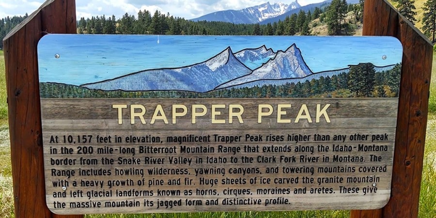
Trapper Peak highway sign near Darby, MT
Although not as dramatic as the view from Highway 93, you can also see the summit from the south as you travel the West Fork Road (MT 473) towards Painted Rocks Reservoir.
Along with Lake Como and Skalkaho Falls, Trapper Peak is one of the iconic natural features of the Bitterroot Valley.
Trapper Peak’s Formation
Tens of millions of years ago molten rock rose to the earth’s crust, then cooled to form huge expanses of granite rock that formed the Bitterroot Mountains.
Tectonic plates were colliding, magma was pushing from below, and the entire top of the Bitterroot Mountains slid dozens of miles to the east.
It was time for new peaks to emerge, and Trapper Peak was born.
Our Bitterroot Mountains article has a fascinating video that explains how the Bitterroot Mountains were formed, and it’s quite the story.
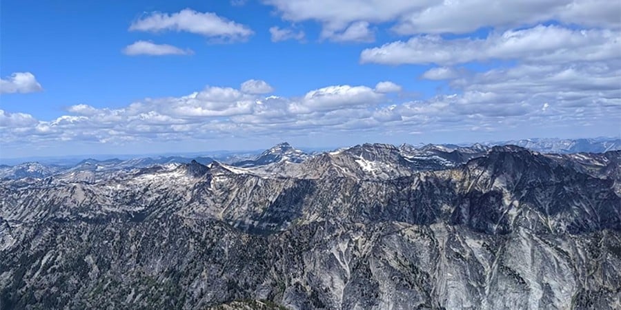
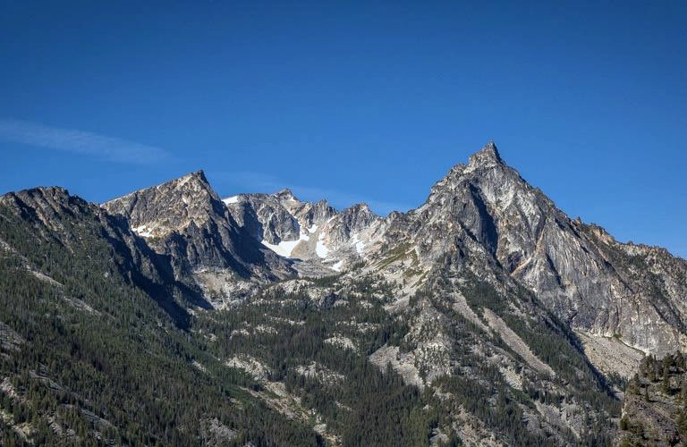
View from Trapper Peak
Flash back to a couple million years ago and this area was mostly covered in glacial ice.
Things looked a lot different around here during the Pleistocene Ice Age.
Huge glacial ice sheets were on the move, and they were cutting U-shaped canyons in the Bitterroot Mountains until they melted about 15,000 years ago.
Trapper Peak’s jagged granite peaks, horns and circs were carved and shaped by these glaciers, leaving behind the spectacular scenery we enjoy today.
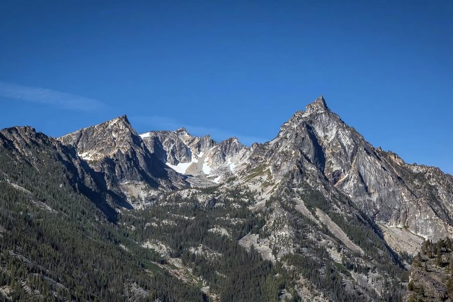
It’s a Popular & Challenging Hike to the Summit
Anywhere you find 10,000′ peaks, you’ll find hikers, climbers, and peak baggers heading to the top.
So it’s no surprise that hiking to Trapper Peak is a popular summer activity in the Bitterroot Valley.
The most popular route to the summit is the Trapper Peak Trail, which begins at the Trapper Creek Trailhead located at the end of Forest Service road 5630-A.
The trailhead sits at an elevation of approximately 6,400 feet.
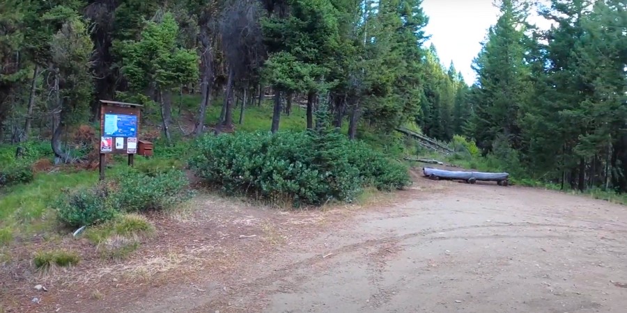
Trapper Peak Trailhead
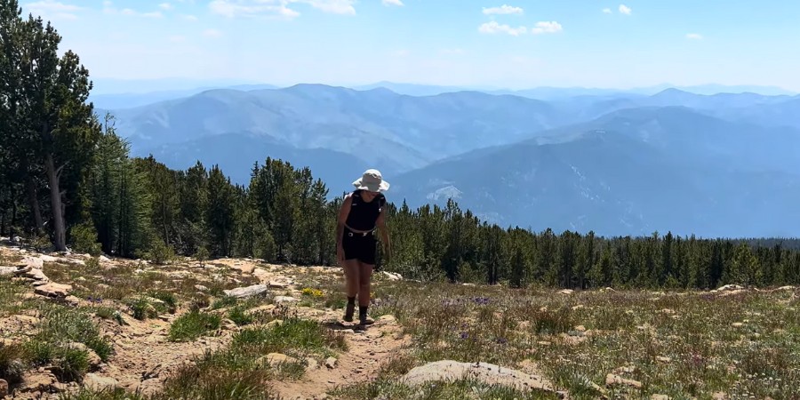
From there, the trail climbs 3,800 feet over 4 miles one-way to reach the summit of Trapper Peak at 10,157 feet.
As the excellent video below shows, most of the trail passes through pristine sub-alpine forest on a well maintained, but steep trail.
Once you emerge from the tree line, things become a little more challenging as the trail is less obvious and there’s plenty of scrambling on the loose rocky trail.
Technically, Trapper Peak’s summit is a year-round destination, but only experts would consider taking it on during the winter months, and we’re guessing that list is short.
Snowshoes, crampons, and ice axes in the snow and cold seems like the hard way to take in the views from the highest point around.
But even in the summer months it’s moderately difficult hiking, and hikers should be prepared with plenty of water and extra layers as weather can change quickly around here.
Hikers should also be prepared for snow or ice on the trail, and ensure they have all the necessary gear for a safe journey.
If you’re planning a trip to Trapper Peak, be sure to consider the time of year, weather conditions, and your physical fitness for this demanding hike.
popular articles on Bitterroot Info
Trailhead Location and Access
Trapper Peak is a popular hiking destination, offering impressive elevation gains and views.
To reach the Trapper Peak trailhead from Darby, MT, head south on US Highway 93 for 4.3 miles, then turn west onto West Fork Road (State Highway 473).
If coming from the south, you can access West Fork Road via Conner Cutoff Road, approximately 23 miles north of Chief Joseph Pass on the Montana-Idaho border.
Once you’re on the West Fork Road, drive about 7 miles west until you see signs for Forest Service Road 5630.
Hiking to Trapper Peak
Make a right turn and follow a winding gravel road for roughly 5 miles.
You’ll come to a fork in the road where you should veer right onto FS Road 5630-A.
The final stretch is often rugged, particularly during spring when conditions can be wet or muddy.
Look for the parking area and markers indicating the start of Trail #133, where your hike to the summit begins.
Trapper Peak Facts & Figures
Trapper Peak stands tall in the Bitterroot Mountains of western Montana.
The peak is nestled within the Selway-Bitterroot Wilderness Area of the Bitterroot National Forest.
| PEAK ELEVATION | 10,157 ft |
| TRAILHEAD ID | #133 |
| TRAILHEAD ELEVATION | Approximately 6,400 ft |
| TRAIL LENGTH | 4 miles one-way 8 miles round trip |
| ELEVATION GAIN | Approximately 3,800 ft |
| ROUTE TYPES | Class 2-4 scrambles |
| BEST SEASON | July through September |
| TYPICAL TIME REQUIRED | Full day for most hikers |
| RECOMMENDED GEAR | Sturdy hiking boots, seasonally appropriate layers, navigation tools, map, emergency gear, water, bear spray. |
Rising 6,000 feet above the Bitterroot Valley floor, Trapper Peak claims the title of the highest summit in the Bitterroot Mountains and the larger Bitterroot Range.
Trapper Peak is the 200th tallest summit in the state, about 1/2 mile shorter than the tallest summit, 12,799′ Granite Peak in the Beartooth Mountains.
That’s a Good Question
Trapper Peak rises 10,157 feet above sea level.
Granville Lee Shook named Trapper Peak in 1876 due to the success of fur trappers in the area.
Trapper Peak is located in southwest Montana near the town of Darby, MT.
Additional Resources
Summit Post’s article with additional hiking information.